 |
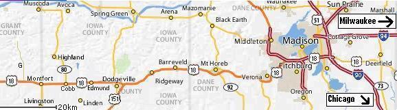
Starting from Madison, Wisconsin at the right edge of the map below:
|
Drive west from Madison on highway 18. About 40 miles west of Madison, as you near Dodgeville, you must stay on highway 18, but must exit the freeway to do so. The exit will be marked "Highway 18, Dodgeville". You will then drive west about 15 miles beyond Dodgeville, passing through 3 small towns (Edmund, Cobb,and Montfort). Two miles west of Montfort, look for county highway G which is a sharp right turn. At this point you will be on the map below.
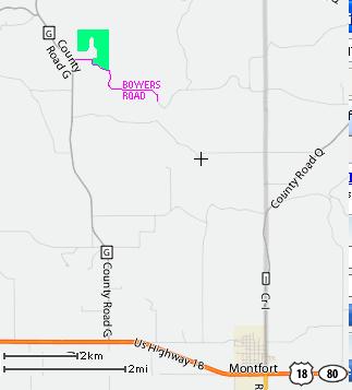 |
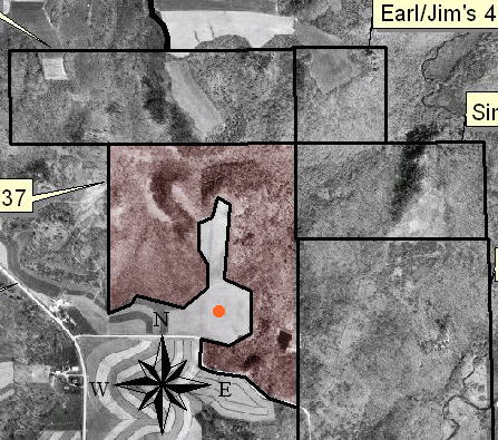
Drive about 4½ miles north on county G until you come to Bowers Road, which is marked visibly. Turn right onto Bowers Road. At this point, all the woods on your left (to the north) will be McFarland land, colored green on the map above. You can either park on Bowers Road near G, so your car can be seen from the 2 nearby farmhouses, or drive half a mile along Bowers Road: there will be a gate opening softly to the left. It is the entrance to a neighbor's land (the Dieters). If the gate is open, they will let you park near their new log house, which will reduce the likelihood of vandalism, but make sure you ask when they plan to leave, so you don't get locked in. McFarland land is tinted reddish in the map below. To the east is property of the Dieter family; to the north is DNR land designated as wildlife habitat. The map below is about 1¼ miles wide.
 |